Last updated: 2026-06 · Fares, routes, and app support change often, so please double-check on Naver Map, KakaoMap, or a similar service before you actually board.
"Why Are There Separate Green and Blue Buses?" — Once You Know the Colors, You're Halfway There
Stand at a bus stop and you'll see blue buses, green buses, red buses, and sometimes yellow buses rolling by one after another. What first-time visitors find most confusing isn't the route map — it's these colors and numbers.
They all look like the same city bus, but in Korea the color IS the route's character.
Just being able to tell the colors apart already tells you about 80% of what you need to know: whether a bus loops around the neighborhood, cuts across the city, or heads out to a neighboring city. Below, we'll look at the color system and number rules with Seoul as our main example, cover how they differ in other cities like Busan, and even show you how to use apps to board safely even if you can't read the numbers.
1. Read the Color First — Seoul's 4-Color City Bus System
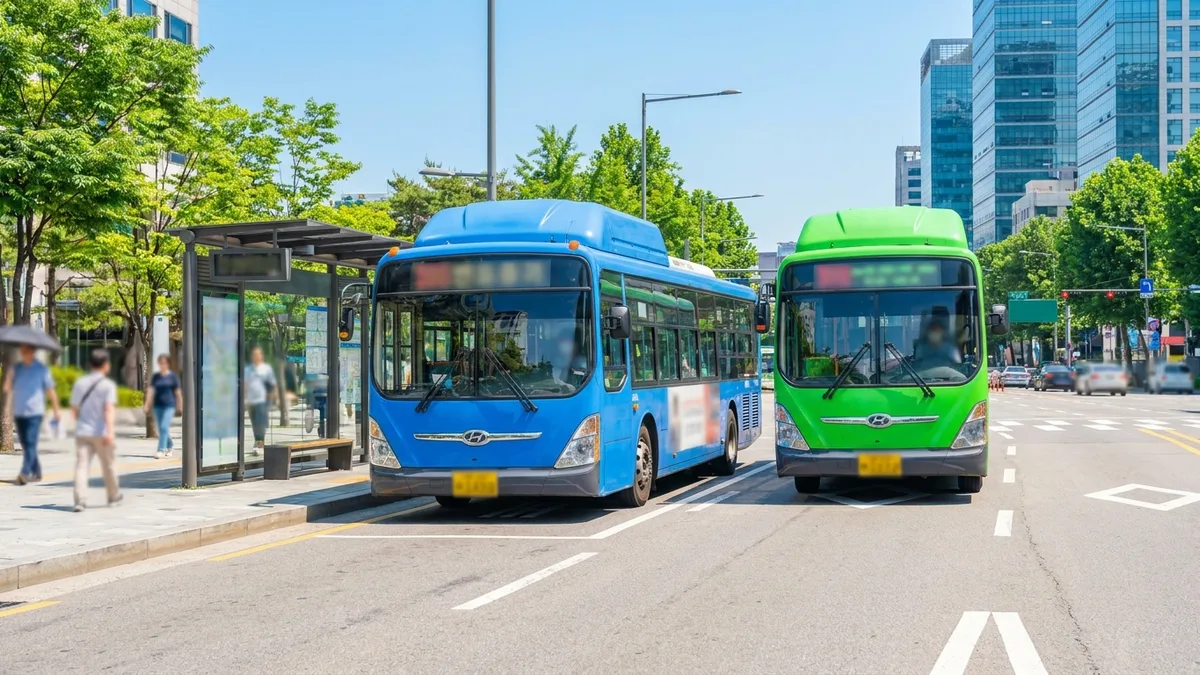
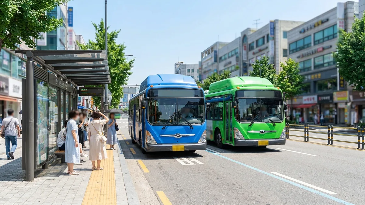
Seoul's city buses are divided into four colors according to a route's character. This color system also applies in a similar way across the greater Seoul area, including Gyeonggi and Incheon.
| Color | Name | Role | Number Length |
|---|---|---|---|
| 🔵 Blue | Trunk Bus (Trunk) | The main routes that run long, straight stretches along the city's major axes | 3 digits |
| 🟢 Green | Branch Bus (Branch/Feeder) | Short routes linking neighborhoods to subway stations and trunk buses | 4 digits |
| 🔴 Red | Wide-area Bus (Rapid/Express) | Fast connections between Seoul and the greater metro area, including Gyeonggi and Incheon | 4 digits (usually starting with 9) |
| 🟡 Yellow | Circular Bus (Circular) | Short routes that loop around a small downtown or subcenter area | 2 digits |
Here's an easy way to remember them.
- Blue = far and straight. It runs long, cutting across the city. It's your default axis when heading to an unfamiliar neighborhood.
- Green = close, neighborhood. These are "connector" buses that take you to the subway station or a main road. They usually go deep into the residential areas.
- Red = out of the city. It makes few stops and quickly links Seoul with nearby cities. It's the most expensive.
- Yellow = one loop in place. It's a short route that circles around a downtown area or tourist spots, which makes it surprisingly useful for travelers.
For reference, in some areas you may see orange-painted Demand Responsive Transit (DRT) buses. DRT itself has been running for a while, and a unified orange paint scheme is a recent trend. These run on request rather than fixed routes, and the areas they serve are still limited.
2. Read the Number — The "Zone" Is Hidden in the First Digit
Once you know the color, next comes the number. Seoul divides the whole city into 8 zones numbered 0 to 7, and the first digit of a bus number points to that zone.
| Zone Number | Main Districts |
|---|---|
| 0 | Jongno-gu · Jung-gu · Yongsan-gu (downtown) |
| 1 | Dobong · Gangbuk · Seongbuk · Nowon (northeast) |
| 2 | Dongdaemun · Jungnang · Seongdong · Gwangjin (east) |
| 3 | Gangdong · Songpa (southeast) |
| 4 | Seocho · Gangnam (south) |
| 5 | Dongjak · Gwanak · Geumcheon (southwest) |
| 6 | Gangseo · Yangcheon · Yeongdeungpo · Guro (west) |
| 7 | Eunpyeong · Mapo · Seodaemun (northwest) |
How to Read Trunk Buses (Blue · 3 Digits)
A three-digit number reads in the order [departure zone][arrival zone][route serial number].
For example, trunk bus 472 starts in zone 4 (Gangnam · Seocho) and heads toward zone 7 (Mapo · Seodaemun), and it's route number 2. Just looking at the first two digits gives you a rough sense of which direction the bus is going.
How to Read Branch Buses (Green · 4 Digits)
A four-digit number is [departure zone][arrival zone][two-digit serial number (11–99)].
For example, branch bus 6512 is a neighborhood connector route linking zone 6 to zone 5. Generally, the more digits, the more densely the route winds through a smaller area.
How to Read Wide-area Buses (Red) and Circular Buses (Yellow)
- Wide-area (Red): usually a four-digit number starting with 9 (e.g., 9401). It links Seoul with Gyeonggi and Incheon.
- Circular (Yellow): a two-digit number (e.g., No. 01). The first digit is the zone and the second is the serial number, for a short route that loops around the downtown area.
Here's the key trick. Remember that 2 digits means a neighborhood loop, 3 digits means a city trunk line, and 4 digits means either a neighborhood connector (green) or out-of-city (red) and you'll be right almost every time. Looking at the color and the number of digits together makes it even more accurate.
3. Is It Only Seoul? — Other Cities Use Different Systems
This color-and-number rule is fundamentally based on Seoul (and the greater metro area). Other cities use their own systems.
- Busan: the color distinctions are similar. Blue = trunk (connecting major sections), green = branch/village bus (residential areas ↔ subway stations), red = express (few stops, long distance). However, the number's zone rule differs from Seoul's.
- Other cities (Daegu, Gwangju, Daejeon, etc.): many cities distinguish trunk/branch/express by color, but the numbering rules vary from city to city.
So the most practical approach for a foreigner is to guess a route's character from its color, but confirm the exact route and direction with a map app.
4. How Not to Get Confused Even If You Can't Read the Numbers — Check with an App
It's fine if you can't memorize the numbering system. Most Korean people check with an app too.
- Enter your destination in Naver Map or KakaoMap and it will tell you which color and number bus to catch, where to board, where to get off, and even real-time arrival information. They support an English interface too.
- Search a bus number and the full sequence of stops comes up, which helps you avoid confusing the direction (inbound/outbound).
- Bus stop electronic displays and signboards also show the route color and number together, so cross-checking with the app makes it certain.
5. Fares Differ by Color (as of 2026-06 · official confirmation recommended)
Color is directly tied to fare, too. The below is general guidance based on Seoul, and since exact amounts can change, please check the official information.
- Regular city buses (blue · green): about ₩1,500 with a transit card.
- Wide-area buses (red): the distance is longer, so they cost more, at about ₩3,000.
- For adults, the cash fare and the transit-card fare are the same (₩1,500 on Seoul city buses); only teens and children pay slightly more in cash. On some Seoul routes, cash payment has been abolished altogether. The transfer discount also applies only to transit cards, so if you transfer two or more times, a card is far more advantageous. The transfer discount applies when you reboard within 30 minutes of getting off (within 1 hour between 9 p.m. and 7 a.m.).
- On top of that, Seoul's "cashless buses," which don't accept cash at all, are growing to over 100 routes, so a transit card is practically essential.
A transit card (like T-money) is a prepaid card you charge and use without a bank account or identity verification. Buying one with cash at a convenience store and charging it there is the most reliable method (starting in March 2026, you can also buy single-ride tickets and short-term Climate Card passes with an overseas card at kiosks in 273 Seoul subway stations).
Frequently Asked Questions (FAQ)
Q1. Are there buses with the same number but a different color? A. If the color is different, it's usually a separate route belonging to a different route system (trunk/branch/wide-area). Even if the numbers look similar, please check the color and number of digits together. When in doubt, searching the number in an app makes it clear.
Q2. Why are red buses more expensive? A. Red (wide-area) buses make few stops and are long-distance routes that quickly link Seoul with nearby cities, so the fare is higher. Unless you're traveling between cities, there's no real need to take one.
Q3. Can foreigners board just by looking at the color and number? A. You can guess whether a bus is for the neighborhood, the city, or out of the city from its color, but checking the exact direction and drop-off stop with Naver Map or KakaoMap is the safest.
Q4. Are yellow buses useful for travelers? A. Yes. Circular (yellow) buses run short loops around downtown areas and tourist spots, so they're often useful for moving between city attractions. There aren't many of these routes in service, so check in an app beforehand.
Q5. Do Busan and Daegu use the same number rules? A. The color distinctions are similar, but the number's zone rule differs from city to city. You can't apply Seoul's rules as-is, so guess only the character from the color and then confirm the route with an app.
Q6. What about intercity travel (KTX, express buses) rather than city buses — how do I book that? A. The official KTX and express bus sites sometimes decline foreign cards. With LACHA, you can book both KTX and express buses in one app using overseas payment methods like Alipay and WeChat Pay, without a Korean phone number or identity verification.
Want to search and book KTX and express buses in one app? Check out LACHA.
Built to work without a Korean phone number or bank account, with overseas payment methods like Alipay, WeChat Pay, and Apple Pay. Taxi hailing plus KTX, express bus, and airport railroad (AREX) booking — all in one app.
Download now


Note: The fare, route, color-system, and app-support information in this article is general guidance compiled from public sources as of June 2026, and may vary by city, route, and point in time. For exact routes and fares, please be sure to check on Naver Map, KakaoMap, and each local government's official transit information.